
Could an attractive floor plan survive a corrected boundary, an unavailable drainage outlet or a driveway too steep for construction equipment? Before approving rooms, require four results: an annotated legal envelope, a practical building zone, a constraint register and a formal sign-off gate.
Architectural design should begin with a verified site brief, not a floor plan
Architectural design should start with verified site evidence, not a preferred room arrangement. The first gate confirms boundaries, planning controls, access, services, drainage and preliminary ground conditions under the rules current in the project’s jurisdiction.
What site information should a homeowner collect before appointing or briefing an architect?
A single-home site brief records constraints affecting one custom house. Planning terminology, approval procedures and consultant responsibilities vary by jurisdiction.
- Obtain current title, ownership, easement and covenant records to establish legal rights and restrictions.
- Commission licensed boundary and topographic surveys showing levels, access, visible services and significant site features.
- Request planning, flood, road and utility records for interpretation by the architect, planner or relevant engineer.
- Assign drainage questions to a civil engineer and ground-risk questions to a geotechnical engineer.
- Label each item as a confirmed record, consultant interpretation or unresolved assumption.
Municipal mapping can guide procurement, but it is not parcel proof. For example, Lake Forest Park’s interactive maps show selected development and utility conditions while directing property-specific questions to the city. Planning controls can also involve separate code and mapping legislation, as illustrated by the San Francisco Family Zoning Plan.
Which site assumptions are too risky to carry into concept design?
Do not treat seller plans, satellite images, old surveys or neighboring construction as evidence of a boundary, easement, sewer connection, lawful access, contour, stormwater outlet or approval pathway.
Accessibility goals must also be stated early. If an accessible design brief applies, the 2010 ADA Standards provide a 30 by 48 inch clear floor or ground space for wheelchair positioning, although the project team must confirm which local requirements govern a private home.
Allow only provisional massing sketches while critical investigations remain open. The next action is to convert verified planning controls into the legal buildable envelope.
Planning controls define the legal buildable envelope of a new home
The legal buildable envelope is the part of a property where a house may potentially be approved after setbacks, easements, height limits, site coverage, protected features and access requirements are applied.
How do setbacks, site coverage, and height limits change architectural design?
Confirm the parcel designation through the responsible authority, then read every applicable provision rather than relying on a map alone. The City of San Diego, for example, publishes an official zoning map, while Lake Forest Park describes its parcel mapping as a reference tool requiring project-specific confirmation.
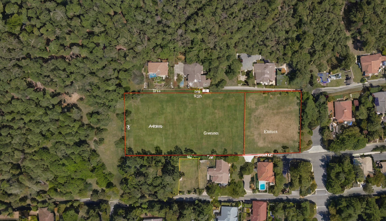
Planning controls define the legal buildable envelope of a new home shown as an editorial planning reference.
| Control | Evidence to verify | Effect on the footprint | Question for the authority |
|---|---|---|---|
| Setbacks | Current measurement rules | Reduce available width or depth | Can eaves, stairs or balconies project into them? |
| Coverage and floor area | Definitions and exclusions | Limit ground-floor or total area | Do garages, basements and accessory structures count? |
| Height | Datum, slope and roof rules | Changes storeys and roof form | How is height measured across sloping ground? |
| Easements | Title, survey and service records | Create no-build or access strips | Is construction, relocation or encroachment possible? |
| Protected features | Overlays and specialist reports | Require buffers or retention | What approval governs removal or disturbance? |
| Parking and access | Planning and road standards | Consume frontage and turning space | What crossing, visibility and parking rules apply? |
The New York City residential bulk regulations show why separate checks matter. Lot area, yards, lot coverage, height, setbacks, permitted obstructions and balconies sit in distinct provisions, while accessory parking is addressed in another chapter. Applicable rules vary by district, lot configuration, building form and geography.
Which easements, rights of way, and protected features can prevent construction?
Draw an annotated-envelope diagram showing the title boundary, required offsets, registered easements, physical rights of way, protected trees or waterways, drainage corridors, access strip and remaining candidate footprint. Municipal critical-area mapping may omit sensitive features on private property, so the planner, licensed surveyor and relevant environmental or utility authority must confirm each constraint.
The remaining legal envelope is not automatically the practical or economical footprint. Retaining work, utility protection, vehicle turning and drainage may shrink it further. A licensed survey should therefore control the architectural base drawing.
A licensed site survey should control the architectural base drawing
A licensed boundary and topographic survey should become the architectural base because it replaces approximate property lines and ground levels with verified information appropriate to the site and intended design stage.
What must a boundary and topographic survey show?
Ask the architect and licensed land surveyor to agree on the applicable professional standard, coordinate system, vertical datum, contour interval, accuracy, certification and permitted uses. A planning survey may not provide the legal certainty or setting-out accuracy required for construction.
- Confirm boundaries, dimensions, bearings, survey monuments, easements, rights of way and apparent encroachments.
- Record contours and spot levels at slope changes, corners and proposed building areas.
- Locate roads, curbs, driveway crossings, drains, utility covers, visible services, poles, significant trees, buildings, retaining structures and fences.
- Extend the survey where permitted to record adjoining walls, windows, trees, road levels and drainage features affecting access, excavation, privacy or approval.
- State excluded areas, concealed services, inaccessible features and boundary evidence requiring further investigation.
How do contours and level differences alter a house footprint?
Test surveyed levels before fixing room positions. A modest level change may permit a single slab with controlled cut and fill; a stronger cross-fall may favor stepped slabs, split levels, a basement or an elevated structure. Each option changes excavation, retaining walls, soil disposal, waterproofing and imported-fill costs.
Check entrance paths, parking connections, thresholds and gradients against applicable accessibility and building requirements. If the accessibility brief follows the ADA reference, dining and work surfaces are set between 28 and 34 inches above the finish floor or ground. Local residential requirements still need confirmation.
Do not select foundations from contours alone. A geotechnical investigation must assess soil, fill, groundwater and slope stability. With geometry established, test whether access, drainage, utilities and ground conditions make the surveyed zone practical.
Access, drainage, utilities, and ground conditions create the main site-cost risks
Access, drainage, utilities and ground conditions determine whether the apparent building area is practical, approvable and affordable.
| Evidence | Responsible consultant | Design consequence | Cost or approval exposure |
|---|---|---|---|
| Access geometry, gradient, sight lines and turning | Architect, transport engineer and contractor | Moves the driveway, garage or house | Crossing works, temporary access and road or fire review |
| Catchments, flood data, discharge point and overflow route | Civil engineer | Changes floor levels, retaining and landscaping | Detention, pumps, upgraded drains or stormwater approval |
| Written service locations, capacity and connection terms | Utility providers and civil engineer | Reserves corridors and plant space | Extensions, relocations, upgrades and provider consent |
| Soil profile, groundwater and slope assessment | Geotechnical and structural engineers | Changes excavation, retaining and foundation concept | Dewatering, disposal, structural work and building review |
Can vehicles, emergency services, and construction equipment reach the proposed house?
Test access against current road-authority, fire-service and building requirements for driveway geometry, sight lines, crossings, parking and turning. Ask the contractor to check crane setup, concrete-pump reach, excavation equipment, deliveries, spoil removal, worker parking and storage. A constrained lot may require a smaller footprint, staged deliveries or a house positioned closer to the road.
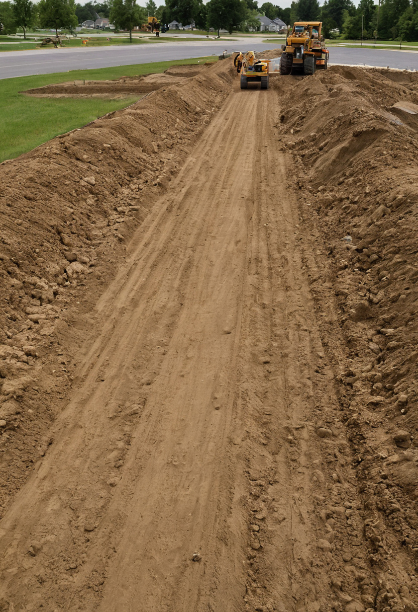
Access, drainage, utilities, and ground conditions create the main site-cost risks shown with practical context cues.
Where can stormwater flow without damaging the house or neighboring property?
Trace water from upstream catchments through the site to a lawful discharge point and safe overflow path. The civil engineer should check local rules for connection, detention, infiltration and overland flow, plus applicable flood or coastal levels. Keep pits, channels, tanks, pumps and swales accessible for inspection and maintenance.
When do utilities and soil conditions force a different building strategy?
Confirm water, wastewater, electricity and communications through written provider information covering capacity, connection points, levels, protection zones, extensions and relocations. Lake Forest Park’s mapping, for example, can indicate water or sewer providers but requires direct verification where service districts remain uncertain.
Investigate soil and groundwater to a scope recommended for the site and proposed house. Geotechnical findings on bearing, settlement, difficult soils, slope stability and excavation should guide structural options rather than justify a generic foundation choice.
Include maintenance in the site strategy. Where natural stone is specified for external paving or drainage edges, the Natural Stone Institute recommends neutral cleaners, stone soap or mild liquid detergent with warm water. Material selection must also account for slip resistance, drainage and weather exposure.
The floor plan should be generated inside the verified buildable and practical envelope
The floor plan should follow a realistic candidate footprint produced from legal, physical and cost constraints.
How should architectural design respond to narrow, shallow, steep, or irregular lots?
Translate the site evidence into four drawings, each reducing uncertainty:
- Plot the surveyed parcel, levels and fixed features.
- Subtract setbacks, easements and protected areas to reveal the legal envelope.
- Remove impractical access, drainage and excavation zones to establish the practical envelope.
- Arrange circulation, rooms and outdoor space inside the remaining building zone.
Narrow lots often favor linear or two-storey layouts with concentrated plumbing. Wide, shallow lots may suit compact or courtyard plans. Steep sites can support split levels, while tapered or corner lots require careful garage placement and upper-floor privacy.
Which site constraints should become design features rather than expensive exceptions?
Convert a drainage corridor into a planted courtyard, a level change into room zoning or an awkward edge into a service spine. Then test the proposal against useful room dimensions, structural spans, outdoor connections, waterproofing and accessible circulation.

The floor plan should be generated inside the verified buildable and practical envelope shown as an editorial planning reference.
Reject adaptations requiring excessive retaining, fragmented roofs, long service runs or maintenance-heavy decks. Abrasive scouring products can scratch natural stone, so material choices must include realistic maintenance rather than appearance alone.
After fixing the footprint, develop orientation, shading, and window placement after the buildable envelope is established. Internal planning can then address zoning rooms within an open-concept home without ignoring the parcel conditions that created the footprint.
Homeowners should use a site-readiness gate before approving the floor plan
Homeowners should approve a floor plan only after the project team records verified constraints, consultant recommendations, cost-sensitive site works and unresolved assumptions.
What should the architectural site-review package contain?
- Collect the current title and survey to establish boundaries, rights and levels.
- Confirm planning controls to produce an annotated legal envelope.
- Map access, drainage, utilities, topography and protected features to define the practical building zone.
- Commission proportionate geotechnical, civil, utility, structural and access advice.
- Compare concept options against both envelopes to remove unbuildable layouts.
- Price excavation, retaining, service runs and temporary works before selecting an option.
- Sign off mandatory evidence and record continuing investigations in a red-amber-green register with an owner and resolution date.
Which warning signs mean a floor plan is not ready for approval?
Stop approval for an unverified boundary, missing levels, uncertain legal access, unknown stormwater outlet, assumed utility connection, unexplained planning breach or difficult ground without preliminary advice.
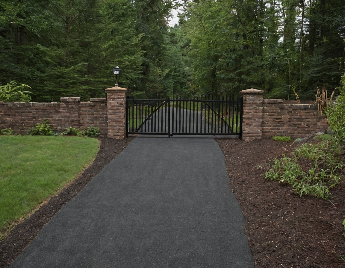
Homeowners should use a site-readiness gate before approving the floor plan shown with practical context cues.
A documented assumption may continue into the next stage if it cannot relocate the house. A priced risk needs an allowance. A constraint capable of changing the footprint must be closed first. Approve evidence before approving rooms.
Frequently asked questions
What are the main legal, physical, and engineering constraints of a residential construction site?
Legal constraints include zoning, setbacks, coverage, height, easements and protected features. Physical constraints include boundaries, slope, access and existing structures. Engineering constraints include drainage, utilities, soil, groundwater, retaining work and foundation conditions.
What are the most common floor-plan mistakes caused by designing before completing a site survey?
Common mistakes include placing walls across setbacks or easements, setting entrances at impractical levels, underestimating retaining work, blocking drainage routes and locating garages where vehicles cannot turn.
What five site features should appear on the architectural base plan before room planning begins?
The base plan should show verified boundaries, ground levels, legal restrictions, access geometry and drainage or utility corridors. Significant trees, structures and adjoining features should also appear where they affect the proposal.
What are the key steps from evaluating a lot to approving a new-home floor plan?
Verify legal records, commission the survey, confirm planning controls, investigate access and engineering risks, draw the legal and practical envelopes, compare concepts, price site works and complete the approval gate.
Can an architect begin concept design before the geotechnical report and utility investigations are complete?
An architect can prepare limited massing options if unresolved assumptions are clearly marked. The homeowner should not approve a footprint that depends on unknown foundation conditions, service capacity or utility locations capable of relocating the house.